

")
Via de la Plata
Via de la Plata has been throughout history one of the most important peninsular ways formed by the union of two great Roman roads mentioned in the "Itinerario de Antonino" main guiding of the Roman roads from Third century A.C.
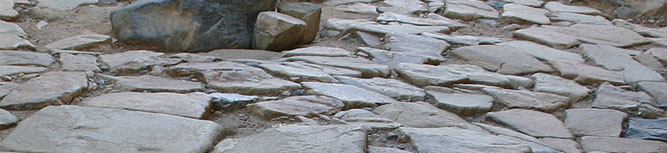
Both carriageways united Axially the west of the Iberian Peninsula and was part of the tract known XXIII, called "Iter ab Ostio Fluminis Anae Emeritam Usque", who communicated Ana River mouth (Guadiana) with Emeria Augusta (Mérida), and route XXIV, the "Iter ab Emerita Caesaraugustam ",which linked the modern cities of Mérida and Zaragoza through Astorga. Of these two big routes, the route that we call Via de la Plata joint Sevilla with Astorga.. Its current name, "Vía de la Plata", comes from the Middle Ages and is derived from the Arabic word "Ba La Ta", meaning stone path.
Via de la Plata crosses geographically the community of Extremadura from south to north. After passing the Real de la Jara (Sevilla province) begins its journey through the town of Monesterio, in the southern province of Badajoz, to move towards the north, where is located the town of Baños de Montemayor, between provincial boundary of Caceres and Salamanca. Enclaves will be left behind as Augusta Emerita (Mérida), an important crossroads and Norba Caesarina colony (Cáceres).
This way, the linear nature has been preserved to this day, marking a strong mark on the territory planning, adapting to the needs of each moment, despite some changes in its route in some particular stages of its history, especially in medieval times with the founding of new Christian populations as the city of Plasencia in the late twelfth century.
Its origin has to be taken to remote times, to prehistory, when it produced the first occupation of the territory. At that time the road is a natural way, the obligated past of the animal species between the plateau and the current Andalusia region and promotes cultural exchange.
In Roman civilization, under Emperor Augusto mandate, it traces its total travel. At present the road is going to be the axis that forms an extensive network of roads that facilitate colonization of the territory.
Throughout history, the road has witnessed several events that demonstrate its use. Was used as a conquest route of African troops invasion to be introduced into the peninsula from the south from 711, and in turn, as a way of penetration for the territory reconquest and repopulation of the by the Christians.
In the Middle Ages, after the conquest, will be built in different parts of the road, places of worship for Santiago apostle. These buildings are witness to the pilgrim passage from the south to Santiago de Compostela.
The road will regain importance in becoming a livestock route in many of the sections, used for the movement of cattle in search of pasture to the north of the Peninsula in summer and from north to south in the autumn, since Extremadura provides a mild climate. This transhumance livestock will be arbitrated by the Honourable Council of the Mesta, an institution created in the thirteenth century.
Via de la Plata will remain in use until today when almost is replaced by the arrival of the railway and the construction of modern roads, which sometimes coincide in their way with her.
Along its route, many patrimonial buildings are related to its history: milestones, mansions, bridges, human settlements, which provide valuable assistance to understand and learn this ancient road.
Today in the twenty-first century, through Alba Plata project, this road of great historical value and heritage, which has allowed the relationship between various human settlements, territorial organization and the transformation of the landscape from Roman times to the present days, has begun to be recovered as way as cultural axis conductive of the territory.
The restoration of part of this heritage, has reactivated the cultural offerings of the course, adapting historic buildings, castles, ancient monasteries and archaeological sites such as hostels, interpretive centers, cultural buildings or just as visited heritage, along its entire route, which was also signed.
These interventions have served to complement and unify the reading of cultural and natural heritage affected by the road and have contributed to the definitive understanding of the historical path, its recovery and ultimate bet its future.